Trail Mountain bike Le May-sur-Èvre -  La Randonnée De La Fressure - Photo
 tracegps
tracegps

User

© OpenStreetMap contributors
Length
Length
53 km
Max alt
Max alt
118 m
Uphill gradient
Uphill gradient
604 m
Km-Effort
Km-Effort  
61 km
Min alt
Min alt
67 m
Downhill gradient
Downhill gradient
608 m
Boucle
Boucle
Yes
Creation date :
2014-12-10 00:00:00.0
Updated on :
2014-12-10 00:00:00.0

(0 Reviews)

Mountain bike
Mountain bike
3h00
Difficulty : Difficult

Scan this QR Code to open this trail in the SityTrail application

FREE GPS app for hiking

Logo SityTrail SityTrail

IGN / Geographical institutes

Download SityTrail from the App Store Download SityTrail from Google Play

Logo SityTrail SityTrail World

The world is yours!

Download SityTrail from the App Store Download SityTrail from Google Play Download SityTrail on Huawei AppGallery

About

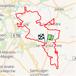
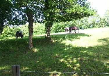
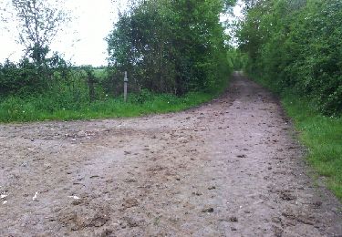
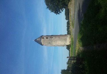
Trail Mountain bike of 53 km to be discovered at Pays de la Loire, Maine-et-Loire, Le May-sur-Èvre. This trail is proposed by tracegps.

Description

Le circuit 50 Km de la Randonnée De La Fressure au May-sur-Èvre (Edition octobre 2009)

Elevation profile

Photos

Positioning

Country:
France
Region :
Pays de la Loire
Department/Province :
Maine-et-Loire
Municipality :
Le May-sur-Èvre
Location:
Unknown
Start:(UTM)
659439 ; 5222913 (30T) N.

Trails nearby

Trail Running Beaupréau-en-Mauges - abbaye andreze - Photo
Running
funkady

Running

Medium
Beaupréau-en-Mauges, Pays de la Loire, Maine-et-Loire, France
12.9 km | 15.3 km-effort
1h 44min
Yes
Trail Running Beaupréau-en-Mauges - andreze - Photo
Running
funkady

Running

Easy
Beaupréau-en-Mauges, Pays de la Loire, Maine-et-Loire, France
12.7 km | 14.2 km-effort
1h 30min
Yes
Trail Walking Beaupréau-en-Mauges - les 2 chapelles - Photo
Walking
ghislaincouppey

Walking

Very easy
Beaupréau-en-Mauges, Pays de la Loire, Maine-et-Loire, France
21 km | 24 km-effort
3h 57min
Yes
Trail Walking Bégrolles-en-Mauges - Abbaye de Bellefontaine-Chemin des canons - Photo
Walking
PatrickMatuszewski

Walking

Easy
Bégrolles-en-Mauges, Pays de la Loire, Maine-et-Loire, France
11.4 km | 13.4 km-effort
3h 1min
Yes
Trail Walking Bégrolles-en-Mauges - Abbaye de Bellefontaine-Eglise Andrezé-Ruines des Hayes - Photo
Walking
PatrickMatuszewski

Walking

Easy
Bégrolles-en-Mauges, Pays de la Loire, Maine-et-Loire, France
8.6 km | 9.8 km-effort
2h 8min
Yes
Trail Walking Le May-sur-Èvre - Le may sur evre  - Photo
Walking
gelineau

Walking

Medium
Le May-sur-Èvre, Pays de la Loire, Maine-et-Loire, France
9.1 km | 10.5 km-effort
2h 13min
Yes
Trail Other activity Bégrolles-en-Mauges - cem - Photo
Other activity
phiboy

Other activity

Very easy
Bégrolles-en-Mauges, Pays de la Loire, Maine-et-Loire, France
12.1 km | 13.4 km-effort
16min
No
Trail Walking Saint-Léger-sous-Cholet - Cholet 1 - Photo
Walking
Marie Claire Lefort

Walking

Very easy
Saint-Léger-sous-Cholet, Pays de la Loire, Maine-et-Loire, France
10.5 km | 11.7 km-effort
2h 13min
Yes
Trail Walking Beaupréau-en-Mauges - andrezé - Photo
Walking
Marie Claire Lefort

Walking

Easy
Beaupréau-en-Mauges, Pays de la Loire, Maine-et-Loire, France
8.3 km | 9.8 km-effort
1h 57min
Yes


Close
My subscriptions